Why Choose
Our Geocoding API?

Accurate Geocoding
Our Geocoding API searches for the most relevant, accurate and up-to-date results every time, even if the address is incomplete.

Global Coverage
Find geocodes to premise level, rooftop level and city center positions in 200+ countries including the USA, Canada, UK and Europe.

Improved User Experience
Delight your customers by providing more accurate, personalised and efficient services based on their precise location.
or find out more below
Geocode Software Features & Benefits
Learn about the many features of the PlotProjects Geocoding API
Easy integration
Our simple-to-use API integrates easily with a variety of platforms and operating systems. Anyone can integrate Geocoding into their website or mobile app, without costly development time.
Accurate results
Whether you need forward geocoding or reverse geocoding, our API instantly returns the most relevant, valid, and accurate location results even if the query is incomplete.
Location-based insights
Get valuable location-based insights such as customer demographics, traffic patterns or market trends, then use it to improve operations, provide enhanced customer experiences and make data-driven decisions.
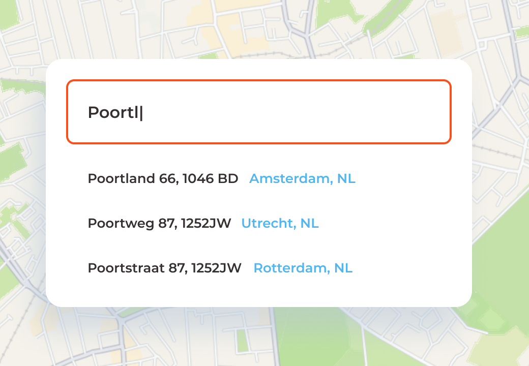
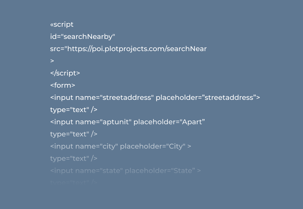
Search & autosuggest places
Provide your users with better suggestions for places or addresses when they’re browsing nearby places or completing online address forms, even when they input an inaccurate or incomplete address.
Affordable geocoding
Our affordable geocoding software includes unlimited usage, high accuracy, quick responses and partial address recognition. You can start for free with no subscription, no prepayment and no credit card needed.
Ready to get started?
Pre-register for our Geocoding API and try it free!
Register NowView our pricing
We offer plans to fit your needs
F.A.Q
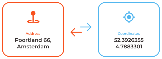
What is Geocoding?
Geocoding is the process of converting text, such as a street address or place name, into map coordinates (longitude and latitude). You can learn more in our handy guide.
What is Reverse Geocoding?
Reverse geocoding converts geographical coordinates (latitude/longitude) into a human-readable address or place name. Check out our Reverse Geocoding guide for more details
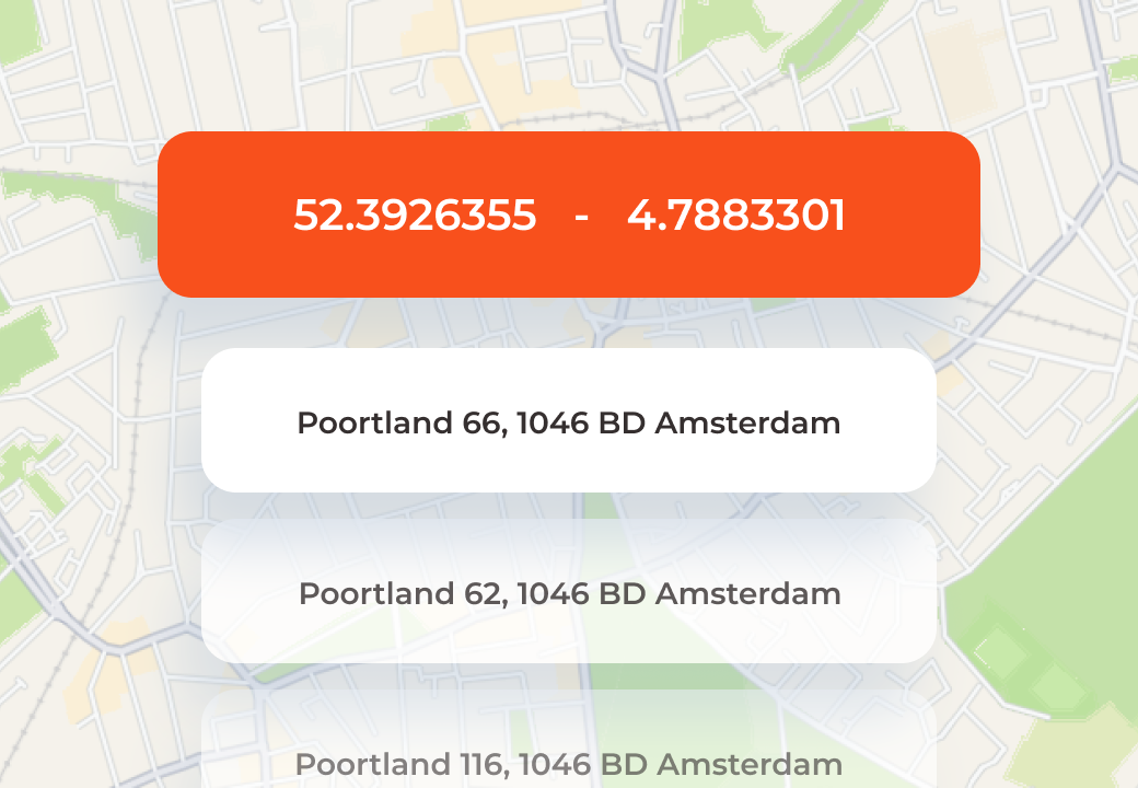
What's an example of Geocoding?
A delivery app could use forward geocoding to place a customer’s address on a map. When a customer enters their address, the app sends it to our Geocoding API, which returns the geographical coordinates of that address.
In reverse geocoding, an application is determining the physical address of a person, a package or a vehicle. For example, a rideshare app would use reverse geocode to find the user’s location in latitude longitude coordinates, then send them to our Geocoding API which returns the human-readable address data.
Why do I need Geocoding?
If you are creating a service that uses location, chances are you will need it. Benefits of Geocoding include:
Transform location data into human-readable addresses or place names
Create maps and location-based customer journeys
Build marketing strategies that target specific clusters of customers
What are some common use cases for Geocoding?
Almost every location-based service uses Geocoding. Some common applications include:
Retail apps can use it to display shop locations
Weather apps can use it to label weather reports with the correct location
Delivery and ride sharing apps use forward and reverse geocode to visualise a user/vehicle/package location on a map and display it as a human-readable address or place
Social Media platforms use it when checking into a location or geotagging photos
How do I use the PlotProjects Geocode API?
Simply contact us to obtain your free API keys, then begin making API calls to our endpoint. Follow our registration guide here.
Is your Geocode API free?
Yes, you can start using our Geocoding API for free! Contact us to get started.
Do you provide international Geocoding?
Yes! We are building a global POI database which makes international geocoding simple and easy.
What data source do you use?
We use data sources such as OpenStreetMap (OSM) to provide worldwide data coverage. OpenStreetMap data is continually updated, edited, and verified by the community. We aim to build up and enrich the OSM data with our own data layers.
Is the PlotProjects API an alternative to OpenStreetMap?
Our API is built with the foundation of data sources such as OSM. The PlotProjects API offers a scalable and easily accessible alternative to OpenStreetMap.
How does PlotProjects Geocoding API compare with Google Maps API?
Our Geocoding API is less expensive than Google’s Geocoding API. We also offer dedicated customer support.
Billing - How is the PlotProjects API billed?
Our pricing is based on the number of API requests per day. We offer a number of plans, including a free tier. You can view our plans here.
Billing - What happens if I go over my usage limit?
Our pricing plans can be customized for your business. We do allow some flexibility as we understand that you may occasionally go over the usage limit while your business grows. If the limit is continually exceeded, it may be time to adjust the subscription to one that better suits your needs.
What POI API services does PlotProjects offer?
We are continually improving and expanding our POI features. We currently offer:
Address Autocomplete API – Capture accurate, verified address data in your online forms
Geocoding API – Forward and reverse geocoding
Places Search API (coming soon!) – Find nearby points of interest filtered by categories, such as restaurants, cafe’s, parks, bus stops, and more!