Reverse geocoding is a way to convert latitude and longitude coordinates to addresses. It’s the opposite of geocoding which lets you find latitude and longitude by address. All kinds of companies use reverse geocoding to find accurate address data for things like delivery updates, location-based advertising, or as part of an address verification solution.
Want to know more? Read on to find out everything you need to know about reverse geocoding, including what it is, why it matters and how to do it. We’ll also tell you more about the things to keep in mind when choosing address validation, geocoding and reverse geocoding software.

What is meant by reverse geocoding?
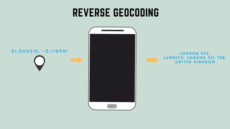
Reverse geocoding is the process of converting latitude and longitude coordinates into the nearest street address to that point. It’s the opposite process to forward geocoding (also know as ‘address geocoding’ or just ‘geocoding’) hence the name ‘reverse’. With the rapid increase in the the use of the internet, mobile devices and location-aware technology, both geocoding and reverse geocoding have become widely used.
Latitude and longitude is great for maps, but users often need more context. A reverse geocoder supplies additional data such as a place name or street address making it easier for the end user to understand. The ability to accurately identify an address and its exact coordinates opens the door to endless possibilities for businesses. It can help them better understand their customers, learn about certain locations and make the most of location intelligence.
So, a quick recap:
- Reverse geocoding: Convert latitude and longitude to address
- Forward geocoding: Find latitude and longitude by address
Why are geocodes important ?
Companies all over the world need to keep track of addresses. This requires a complex tracking network which must be constantly updated in real time to provide the most accurate address data. This is where geocodes come in. Instead of storing information as text addresses, they are stored as a set of latitude and longitude coordinates called geocodes. Geocodes are important because they’re a universally recognised system for address data that’s used all around the world.
Storing and sorting geocodes is much easier than dealing with big databases of text addresses. This is especially true for businesses that deal with addresses from different countries with their own unique postal systems. Any application or website that uses geocoding can be held to one universal standard and will stand the test of time. Addresses can change but geographical coordinates stay the same, making them the best source of accurate location information.
How does reverse geocoding work? Latitude and longitude to address
The reverse geocode lookup process takes place through a API which converts latitude and longitude to address. This is the opposite process to forward geocoding which lets you find latitude and longitude by address.
The user-friendly software often includes a visual layer so that geocoding data is relayed in a way that’s easy to understand. Behind the scenes, the process takes place via algorithms that append latitude and longitude coordinates from GPS signals, cellular data, Wi-Fi or other identifiers to the closest address, place or point of interest.
Reverse geocoding can be done with different levels of accuracy. Rooftop geocoding provides the highest level of accuracy with the geographical coordinates corresponding to a physical address. Parcel centroid accuracy locates the center of a property, such as the middle of an office block. Thoroughfare geocoding returns one or more nearby locations, and administrative area geocoding connects coordinates to a larger area such as a state or province.
The level of data granularity needed all depends on what service your application provides. For example, if you want your e-commerce website to display the correct form of currency, you would just need to know the user’s current country. However, if you are also providing delivery updates to your customers, you’ll need to know where the package is meant to be delivered.

What is reverse geocoding used for?
Reverse geocode lookup identifies locations nearest to a latitude and longitude coordinate, allowing humans to read the location data they need in order to use a web or mobile application. Businesses can access addresses by using the location’s geocode, and even if an address isn’t available, reverse geocoding software can provide the closest address candidates based on proximity to a landmark.
This is pretty handy for businesses, or any organisation looking for increased accuracy of location data. Aside from identifying an address from a set of geographical coordinates, reverse geocoding can be used for the following applications.
Map applications
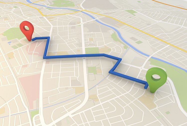
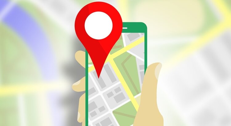
Reverse geocoding is commonly used in map and navigation applications. For example, if a mobile user opens a map application on their smartphone, the built-in GPS will find their location and plot it on the map. It knows where to put the marker because of the latitude and longitude coordinates returned. The user can instantly recognise where they are, instead of just seeing a string of numbers. The reverse geocoder takes the geographical coordinates and returns your location as a human-readable place name, street address or point on a map.
Reverse geocoding for location marketing
Location marketing often begins with reverse geocoding, by which a mobile device transits a user’s geolocation which is appended to an address and used to identify the potential services that may be of interest. For instance, a mobile user may have liked a certain type of restaurant on their social media app. A marketing algorithm can match this preference with the customer’s current location and make recommendations about other nearby restaurants that might be appealing.
Delivery tracking & updates
Online businesses, suppliers and e-commerce websites need to track a constant network of deliveries. To keep things running smoothly, they need to know which deliveries are on time, which are running late or if any have gone missing. Computers can keep track of this information via GPS coordinates, however customers like to see real-time updates or timelines displayed in a user-friendly way. Customer services also need this information so that they can respond to any issues and provide better customer services.
Device tracking
Most people carry a smart device with them at all times. A smartphone, fitness tracker or navigation device can use geolocation services to display human readable coordinates for any number of reasons. For instance, a navigation device can help users find their way around, or a fitness tracker can help users keep track of their exercise routes. Smartphones can also be tracked by GPS coordinates or other means to provide real-time location data that can help marketers understand the behaviours, locations and behaviours of potential customers.

Fleet tracking reverse geocoding
Often used alongside delivery tracking, reverse geocoding for fleet tracking enables organisations with fleets of vehicles to keep track of where they are at any given time. This information can be stored and accessed by fleet operators or to conduct analysis and improve efficiency of supply chains and transport routes.
Social applications
Social media applications can use reverse geocoding as part of their social network tools. For instance, when taking a photo at a specific venue or point of interest, GPS coordinates and geocodes can be used to tag the photo with its location via a reverse geocode lookup.
Emergency response
In the case of an emergency, reverse geocoding makes it possible to pinpoint the exact location of a caller so that emergency services can be deployed quickly to an accurate location. In many cases, a distressed caller may be unable to describe their location or they may provide inaccurate information. Reverse geocoding uses the caller’s GPS coordinates or other identifiers to pinpoint the exact location they’re calling from.
Payment processing
As web services become globalised, websites need to be able to convert prices so that they can display and collect the right amount for each transaction. You wouldn’t want a business in the UK to be displaying products priced in another currency because you could lose customers and also lose money due to exchange rates. A reverse geocoding API can solve this problem by gathering the customer’s location data and converting all values to their real-time location and currency.
Fraud prevention
Financial services organisations use reverse geocode lookup to aid in detecting and preventing fraud. For example, if a credit card is used at a point of sale, it’s logical that the credit card holder should be there too. If the credit card holder’s smartphone location can be confirmed to be at the same address, it indicates that fraud is not present. And if they’re not, additional security checks may need to be applied.
Address verification & reverse geocode lookup
Address verification is a big part of reverse geocoding. It ensures that the address data obtained by reverse geocode lookup is reliable. For instance, even using rooftop level accurate geocodes, you can’t ensure that the physical address is real and deliverable according to postal official address databases.
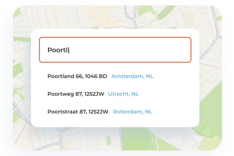
Also known as address validation, it takes place via an address validation / verification API that confirms the accuracy of postal addresses compared against official global datasets. These types of APIs come equipped with reverse geocoding and reverse lookup capabilities. The solution provided by PlotProjects also comes with additional features like address autocomplete which can further enhance the user experience.
Address autocomplete APIs can be easily integrated into websites and mobile apps to ensure that users input the correct address when completing online checkouts. This helps to improve data quality, reduce errors and prevent failed deliveries. Geocoding and reverse geocoding are a big part of this technology to ensure that address data is accurate.

Choosing the right reverse geocoding API
Choosing a reverse geocoding API comes with a number of considerations. What you need will all depend on what service your application provides.
Data granularity
One important factor in the decision making process is the level of data granularity needed. You may need to interpret several forms of location data to deliver the best service. You may need to display location information in towns, area codes, streets, addresses, landmarks or even countries. For instance, for fleet tracking, you might need your reverse geocoder to identify to identify roads and highways. For a delivery service, you might need exact addresses. But if you run ride sharing service, you might only need to know landmarks or business names. In each case, your reverse geocoder must be able to work within your system to translate location data into the proper form.
Maintenance
Another consideration is how often your data refreshes. It’s important for any system to be able to keep up with incoming data. By choosing the right geocoding API, you can rely on your provide to maintain the system rather than you having to do it yourself.
Price
Price is another big factor to consider. Developing your own reverse geocoder requires a big database of reference points, shapes and other geo data. This takes significant amount of time and development costs. The more granular the data and the wider coverage of area you need, the harder it will be to build and maintain your own system. The data will then need to be organised, prepared and queried before your team can begin writing the application’s code.
Address verification
Furthermore, the accuracy of the addresses obtained via reverse geocode lookup can be questionable. Therefore, you will need to ensure the accuracy of the address data by employing an address validation and verification tool. Advanced tools like PlotProjects come complete with forward and reverse geocoding, address verification, and address autocomplete API capabilities.
Get started with location technology today
PlotProjects’ SDK, APIs and dashboard offer all the tools you need to build accurate and efficient location functionalities into your websites and mobile apps. We can help you all of your location needs, from address autocomplete and geocoding, to places search, routing, geofencing for mobile apps, or developing geo ads and hyper local marketing for the web.
We can also assist you with the execution of your local marketing needs. Let digital advertising empower your local store and branches. Our specialists are ready to help you to advertise on the leading digital channels with the most effective advertising formats, so you can focus on running your business successfully.
To speak to us about how our solutions can work for you, contact us today.
Want to learn more?
Get in touch with us!
