Building your own geofences might seem like an easy task, but it’s important to understand the many challenges involved. While it’s possible for developers and product owners to set up geofencing in their apps, many companies come to the best geofencing software providers such as PlotProjects to complete the process.
In this article we’ll discuss:
- Why geofencing and geolocations are useful
- How to set up geofencing
- The many challenges involved in building your own geofences
- Why to use a geofencing software solution like PlotProjects
Why geofencing & geolocations are useful
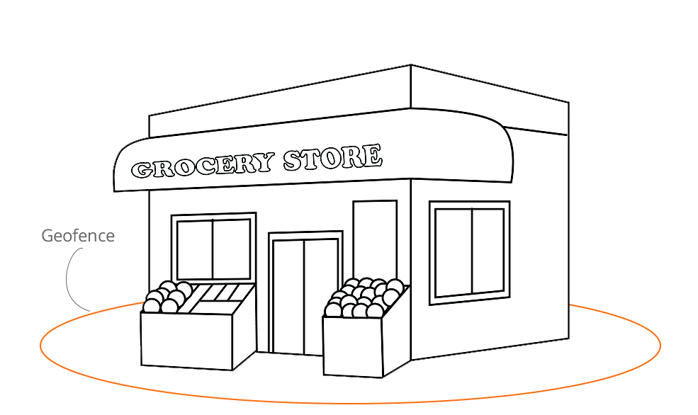
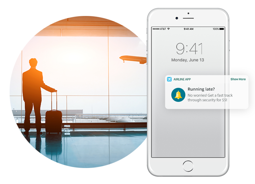
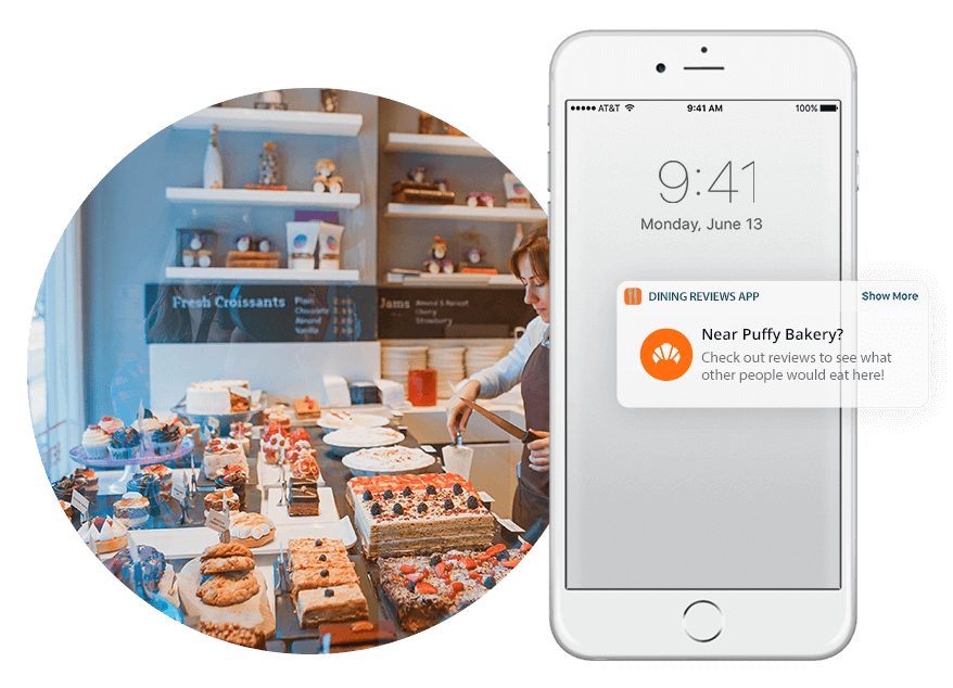
Geofencing software, also know as ‘geofencing marketing software’ or ‘ geofencing advertising software’ is a very useful and valuable tool for businesses. It’s used to monitor a user’s geolocation through specific events like entering, exiting or staying within a specific virtual radius called a geofence. Most commonly, geofencing software is used in mobile apps to trigger promotional messages and experiences for app users who are in or near a geofenced location.
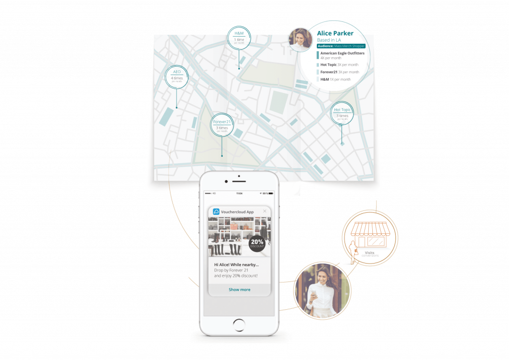
Using geolocation and geofencing, you can engage your customers in real time and use their geolocation data for relevant, contextual location-based marketing and advertising. Not only can you use this information for highly targeted marketing, but it can offer valuable insights into the consumer mindset.
There are many examples of how geofencing marketing software is used by businesses. You could send app notifications and discounts to customers as they walk past your store, or geo-conquest your competitors like Burger King did in their ‘Whopper Detour’ campaign. Geofencing also makes it possible to delight your app users with location-based experiences such as curbside pickup (click & collect), in-app gamification, loyalty rewards and more.
In marketing terms, with a geofencing solution you can target the current position of the user. Whereas a geolocation campaign refers to the history of the user’s position, so you can target users who have been detected in a certain location, say over the past 30 days.
Whether you’re planning to set up geofencing on your own or you’re using one of the best geofencing software providers like PlotProjects, the technology it is a proven way to help you add fast value to your business.
Geofencing software
Geofencing software is defined as creating a virtual boundary around a real-world location or object, through which a device, an asset or a person can be detected and monitored when entering or exiting the boundary. Also known as geofencing marketing software, it is the solution that makes it possible to create and track these virtual boundaries.
When looking for the best geofencing software, you’ll want to find a solution that comes with an array of useful tools and features. High accuracy and low battery use are important, as are easy installation and implementation into your app. You’ll also want to think about geofencing marketing software such as an easy-to-use dashboard, advanced analytics and lots of tools to help you build engaging and effective campaigns.
PlotProjects geofencing software
The PlotProjects platform is a great way to get started with. Hailed as the best geofencing software, we offer an array of top features to help you build accurate location-aware apps. Check out our handy guide to see exactly what features are supported per platform or framework. Or see how we compare to other geofencing providers such as Radar here.
A quick overview of our best features and tools:
- High accuracy, low battery use, no battery-draining GPS
- Unlimited & scalable geofences
- Works when your users don’t have WiFi or cellular data
- Complies with all industry regulations and rules
- Support for beacons & polygons
- Accurate location data
- Easy campaign building and management
- Robust analytics and location data
- Foot traffic, dwell time, visit history
- Real-world insights to help you send relevant notifications
- Send notifications when the app is closed or running in the background.
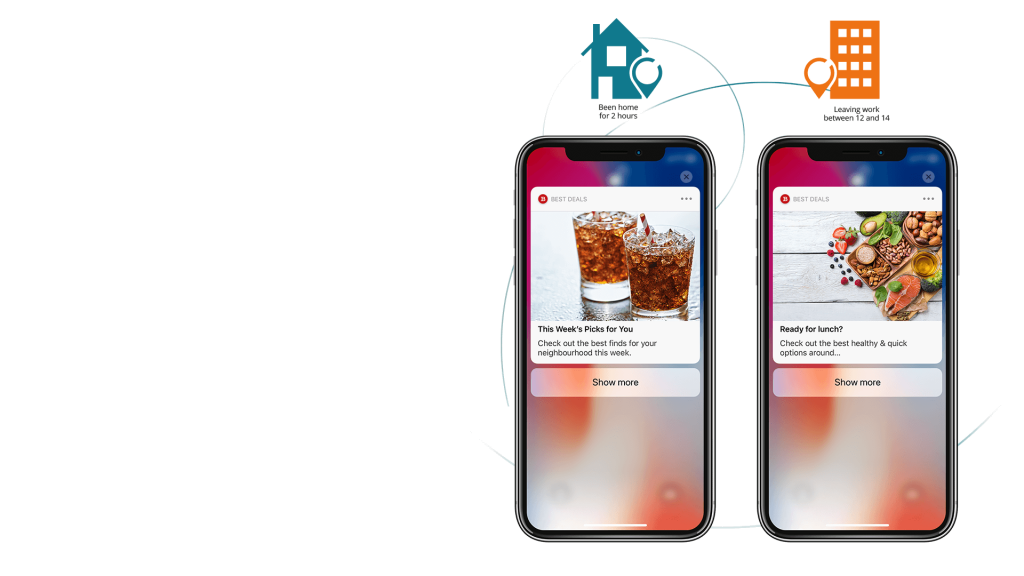
- Home, work & place detection
- Check-in/Check-out / Activity Monitor / Stop Start Detection
- Advance privacy options
- Anti-spam tools
- Easy integrations
- Dedicated support
How to set up geofencing
Wondering how to set up geofencing? Setting up the use of geofences in your mobile app requires specific content including latitude, longitude and radius, as well as an ID so that your geofence can be uniquely identified. The latitude and longitude are used to define the point of interest (point of interest refers to the geofenced area such as a shop, restaurant etc) and the radius is used to determine how wide the geofence will be.
How to create a geofence
When thinking about how to create a geofence, you’ll want to think about exactly what size, shape and number of geofences you require. On iOS and Android, circular geofences are the standard shape. If you require polygonal geofences, these require more specific programming and are monitored using a more complex algorithm.
How to implement geofencing
If you want to implement geofencing, most geofences have the following – you will need to consider these when deciding how to set up geofencing:
- Latitude & longitude
- Radius
- ID (a unique identifier such as ‘home’)
- A list of event triggers for example ‘enter’, ‘exit’ and/or ‘dwell’
How to set up geofencing – things to consider
When you set up geofencing for your mobile app, you’ll discover there are trade-offs between asking the tech team to build it versus using an off-the-shelf solution geofencing solution. Aside from the costs, you’ll want to think about things like your time-to-market, if your solution will be scalable and if you have the relevant expertise to execute it accurately.
We highly recommend that you don’t waste development time on your own solution. It’s a big challenge to face on your own. Instead, use the PlotProjects software and you’ll be ready to send highly accurate notifications straight away. If you’re unsure about which path to take, you might find it helpful to think about the following:
Number of geofences needed
One of the biggest challenges when planning how to set up geofencing is that you only have a limited number to work with depending on the operating system you develop the app for. There are restrictions in place when creating geofences on iOS and Android. Android can monitor up to 100 geofences per application, while iOS can only monitor 20. If you want to set up more than this, you will need to use a geofencing software provider like PlotProjects. Our SDK supports all mobile systems and allows for the creation of an unlimited number of geofences around the world.
How to set up geofencing without battery drain
When thinking about how to set up geofencing, keep in mind that using GPS to constantly monitor a device’s location will drain the battery of the device that eventually will lead to uninstalls. You will need to develop a more efficient solution, or employ geofencing software like ours that is proven to be efficient. Hailed as the industry leader, the PlotProjects technology boasts high accuracy with low battery use.
Network bandwidth usage
When people are on the move, they are not connected to WiFi. Loading and updating locations on the device then communicating the triggered geofences can use a lot of bandwidth which the end user will have to pay for. With the PlotProjects geofencing software, we optimized the communications between our servers and devices in a way that consumes little bandwidth. Everything can work offline without compromising the quality or accuracy of the geofence triggers.
How to set up geofencing with accuracy and reliability
Do you know how to avoid spamming? Can you manage the timing of your notifications? This is another programming consideration, however it can be solved by using a software provider, it is important to then look for providers who deliver an accurate and reliable solution. PlotProjects has more than 10 years of experience and developed its SDK to ensure that notifications are delivered when your app user is actually at the point of interest, and if users visited a point of interest.
Geofencing marketing software
Can your team segment your audience and personalize each notification? Do you have the means to create a dashboard to monitor your geofencing and beacon campaigns? How about dashboard analytics? A/B testing? And the relevant location marketing expertise to build high-converting campaigns? You will need to dedicate a huge amount of time and resources to this, or use our geofencing marketing software which covers all bases.
Easy geofence management
One aspect programmers and tech teams often forget about when asked to set up geofencing in an app, is that after it works it needs to be used, adapted and managed. For that you will need to build an interface so that the customer service team can change the messages the users receive when they are at a point of interest or to keep the points of interest up to date with their opening hours for example. Not all geofences should be triggered all the time and some campaigns may also need to run during a certain time window of the day.
Polygonal geofences
Not all geofences are circular. For example, airports – if you try to fit such a large area in a circular geofence, you might end up including a fair amount of the surrounding area – you may need a polygonal fence. At PlotProjects we employ AI to overcome this challenge.
User permissions
To protect user privacy, apps that use location services must request location permissions. Do you know about foreground and background location access? Do you know best practices when asking for permissions? Or how to motivate users to opt-in rather than opting out? Again, this is where our geofencing expertise and experience is key.
A suite of tools
Our solution comes with a full suite of great features such as anti-spam tools, heatmaps to help you understand user behaviour, custom location metrics such as store visits, plus tools for unlocking more granular insights such as A/B testing and user profiles. What’s more, Stop & Start Detection and Activity Monitor can be combined to trigger events around specific activities. While Check in/Check out opens up opportunities for seamless mobile payments.
How much does geofencing cost?
Building your own solution can be expensive – but with PlotProjects there are no hidden costs or extras. Our Developer Plan is free and includes up to 1,000 geofences and 10,000 monthly tracked users. Our Small Business Plan costs between €100-€500 per month, and our Enterprise Plan is based on custom pricing. You can find out more about our geofencing software prices here.
The best geofencing software
If you’ve decided against setting up your own geofencing, another solution is to use an SAAS or ‘software as a service’ provider like PlotProjects. We offer the best geofencing software that you can implement quickly and seamlessly.
Our extensive geofencing SDK and API is quick to set up and easy to use. It allows you to bypass all of the problems, bugs and limitations you could face on your own. This along with ease of set up and dedicated support makes PlotProjects the perfect solution.
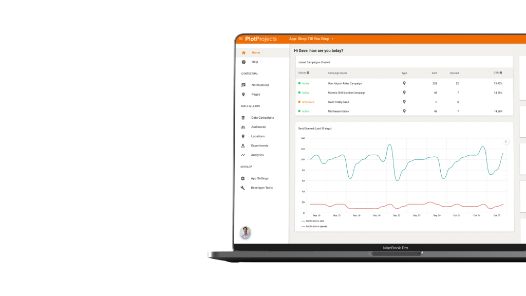
- Choosing to work with the best geofencing software will resolve all the issues mentioned above, with the added benefit of a very short time-to-market.
- We have regular geofencing plugin updates, never resting quality increase and we always update our plugin before a new release of iOS or Android and adapt to the always changing requirements from those operating systems.
- We support some of the largest couponing apps (VoucherCloud/Savings.com) and we work with big brands around the world including Groupon, Coca-Cola, Future Group and many more.
- Privacy and support for storing the events on your own server.
Geofencing software price
Typically the Plot geofencing software price is between $100-$500 per month for a small business. This includes a maximum of 50,000 monthly tracked users, up to 10,000 geofences across 2 apps. However, you can start for free with the PlotProjects Developer package, with up to 10,000 monthly tracked users, 1,000 geofences and 1 app. While an Enterprise package can be tailored to your exact needs and has custom pricing.
You can see more about our pricing here.
How to set up geofencing with PlotProjects
With many years of experience and expertise, our geofencing solution is hailed as the best geofencing marketing software for big and small businesses alike. Ready to get started? Then contact us today or sign up for our free trial.
What we offer:
- Industry-leading geofencing marketing software with high accuracy and low battery use
- Unlimited and scalable geofences
- Support for beacons and polygons
- Accurate location data
- A range of features to help you track key metrics
- Advanced analytics and reporting
- Advanced privacy options
- Cool down and other anti spam tools
- Easy integrations
- Dedicated customer support
- Affordable and flexible prices & bespoke packages
- Hailed as the best geofencing software
- Plenty of helpful marketing and advertising tools and guides
- Full support for Bluetooth beacons
Other useful resources
- Beacon technology – a complete guide
- Geofencing strategies for supermarkets and grocery chains
- How to add gamification to your mobile apps
- Curbside pickup & click and collect – why brands need it
- Best geofencing platform
