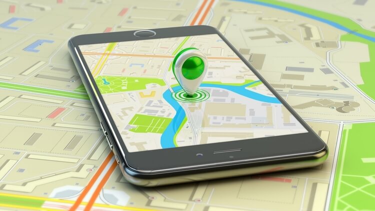
We’ve all heard of Pokemon Go, the popular mobile game that inspires players to get out in the real world for their gaming. There’s something pretty cool about location-based games that blur the line between physical and virtual reality. And thanks to the widespread adoption of smartphones, this popular genre is still growing.
But what exactly is a location-based game? How does location-based gaming work? And how can geofencing optimise your mobile gaming app? Read on to find all the inspiration you need to start building awesome location-based games.

What is a location-based game?
A location-based game is a mobile gaming app in which the gameplay takes place outdoors and progresses via a player’s geographic location. Also known as ‘geogames’ or ‘location-enabled games’, they use location awareness such as GPS and other location-based technology to enable players to engage with their surroundings in a distinct way.
Many location-based games are variants of treasure hunts, manhunts, walking apps and orienteering, usually involving the solving of puzzles and finding of clues via a location-enabled mobile device. The critical part of the gameplay is the changing location of the players, which evolves and progresses the game.
Geogames have come a long way from early games such as PacManhattan and Geocaching to today’s hugely popular geogaming apps such as Ingress Prime, Minecraft Earth and Pokemon Go. Geogames can be single or multiplayer, and can be played in a variety of locations including city streets, department stores and built-up urban environments.
You can see an encyclopedia of location-based games here.
How does location-based gaming work?
Location-based gaming apps have the ability to locate players via GPS, QR codes, Bluetooth and other location-based technology, and use that information to direct users towards specific aspects of the environment or encourage particular types of interactions.
For example, let’s look at one of the best known geogaming apps, Pokemon Go. A massive sensation since its launch in 2016, Pokemon Go is hailed as leading the location game revolution. It uses location tracking and mapping technology to create a ‘virtual world’ where players have to find, catch and train Pokemon characters out in real-world locations.
As users walk around the real world, Pokemon characters appear on the gaming map. The map is an anime-style version of Google maps that swaps out real place names and landmarks with Pokemon-style ones. When players get close to a Pokemon, they can throw AR ‘Poke Balls’ at them to capture them. The aim is to collect as many characters as possible and receive a variety of rewards along the way.
For many players, Pokemon Go was their first experience of an augmented reality game that could be played out in the real world. And its popularity is showing no signs of waning. In 2021, Pokemon Go in-app purchase revenues surpassed 904 million US dollar worldwide, making it the app’s most profitable year since launching.

The benefits of location-based games
When you look at the basics of location-based mobile games it’s easy to see the many potential benefits. Geogames provide an impetus for players to go outside and look for points of interest, travel to those POIs and walk around to trigger in-game events and notifications. This means players might visit new places or experience their regular surroundings in a new and engaging way.
Some of the benefits of playing location-based games include:
- Being outdoors and getting sunshine
- Increased exercise and improved mood
- Better knowledge of local surroundings
- Better navigational skills
- Increased social interaction
- Role playing & strategic decision making
- Reaching a wider demographic
- Discover places in a fun and engaging way
The benefits for businesses
The nature of geogaming apps also means that real-world locations are likely to be visited by higher numbers of people who are playing the game. This is generally considered a benefit by local businesses or attractions who might enjoy increased footfall and sales.
In fact, some businesses leverage location-based games as part of their marketing strategy. For example, a game could take place in a supermarket or department store where customers could be prompted to visit specific departments and displays. Upon completing the game, a customer could be rewarded with a coupon or discount.
Macy’s famously used a beacon-driven gaming campaign to great success during Black Friday. After a massive rollout of Bluetooth beacons in its department stores, customers were prompted to install its app and play a location-based game to win thousands of giveaways. It was a great way to drive some excitement and increase in-store footfall and sales.
Location-aware apps also allow for real-world data acquisition. Advances in geofencing, geotargeting and other location-based technology mean advertisers are now able to reach users in their real-world location and serve notifications when and where they are most relevant. Location data can also help businesses to better understand their customers’ behaviour for better targeted marketing campaigns.

Important features for a successful geogaming app
There are many different types of geogames. From typical ‘treasure hunt’ style games, to manhunting games, capture territory games, storytelling games, university projects and even mass-player geogames that involve hundreds of players.
One thing they all have in common is that accurate location and proximity data are vital components of the game. Participants are required to download an app and share their location. The game can then perform a variety of functions, from keeping track of a player’s location, to sending location-based notifications and alerts.
Creating a location-based gaming app can be a complex process. You’ll want to think about things like easy integration of location-based features, accuracy of locations on your maps, the types of notifications to send to your users, and how to set up triggers for your in-game events. What’s more, apps with highly dynamic proximity detection features can be battery draining.
To bypass these problems, you’ll want to find a reliable location-based technology provider like PlotProjects.
Geofencing in mobile gaming applications
Geofencing is a popular option for location-based gaming apps. It’s very energy efficient in terms of mobile resource consumption, thus helping it go unnoticed by users.
Geofences are virtual boundaries that can be drawn around points on a map to monitor when a mobile device crosses the boundary. A geofence can be set up to trigger specific in-app events such as sending notifications when a user enters or exits the geofenced area.
Location-based games can utilize geofencing as part of their strategy to create better location awareness and more meaningful interactions with users. It is easy to implement and manage geofencing in your app, and it encourages user engagement. It also makes a large amount of customer data available. This can be used to customize and enrich their experience, leading to a more enjoyable and profitable mobile app.
What’s more, geofencing and Bluetooth beacons can complement each other to target locations and trigger notifications in a variety of different settings. Unlike geofences, Bluetooth beacons don’t have to be stationary, and they operate at smaller distances, making them better for targeting micro locations.
While it might seem like a difficult task, there’s some great software such as the PlotProjects SDK that you can plug in to your app to extend its location functionalities. By using the Plot plugin, you can bypass any issues you might face on your own, with access to all the tools you need to send real-time geofencing and beacons notifications to your app users. And with Plot analytics, you can easily manage and optimise your campaigns.

The future of location-based mobile games
The Covid-19 pandemic was a difficult time for the geogaming industry. With much of the world being forced into a lockdown it wasn’t ideal for a gaming genre that relies on movement to different locations to function. However, many developers were able to promote a message of safety and make it easier for players to enjoy stay-at-home features.
At the start of 2020 mobile game downloads saw a rise of 75% in Q1 when compared with the previous year. And the future’s even brighter. 2024 is set to see the global games market generate revenues of $218.8 billion, with mobile games alone predicted to generate $116.4 via consumer spending. Location-based gaming apps might have taken a hit over the past few years, but this popular genre is still booming.
Are you a mobile app developer?
Geofencing and beacons are powerful tools that can be used to build accurate and efficient location functionalities into your mobile apps. By using the PlotProjects technology, you can improve the experience for your users while also increasing your revenue. Our extensive geofencing SDK is quick to set up and easy to use, offering all the tools you need to build and manage your campaigns.
PlotProjects is working with more and more geogaming apps. Using our technology it’s also possible for a user to create their own geofences. To talk to us about how our technology can benefit your app, get in touch today. Our team is on-hand to offer all the help and advice you need. Want to get started? Sign up for our free trial today.
