Location data is a very powerful tool to enhance your mobile app campaigns. It can easily generate very valuable insights about your app users and help you improve app user experience and engagement. So if you want to find our ways to use location data in your campaigns, keep on reading.
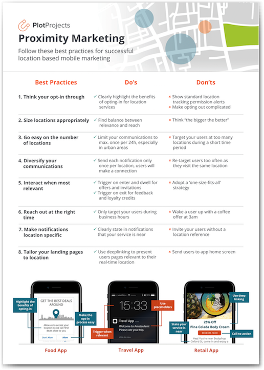 |
Cheat Sheet: The Do’s & Don’ts of Proximity MarketingThe Plot Projects rescue team has assembled a cheat sheet for you with essential best practices to follow and nail your proximity marketing for a relevant mobile app experience that drives engagement. |

How to collect location data?
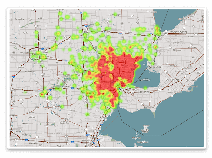
By detecting when a mobile device with your app enters a geofence, you can start to build up a picture of their location history and which locations they have visited and for how long. This can be used to improve targeting of users individually or to build up a larger picture of how all of your app users move across a larger area e.g. throughout a city. For example, below is heatmap based on app users’ location history, visualizing how busy certain areas are in the city of Detroit.
Find out how to convince your app users to share their location details in our blog post about The Perfect Opt-In Experience.
How can location history data be used?
As app administrators thrive on data to improve their user experience and engagement, location based data is also an important component to understand their users’ behaviour in the real world.
Businesses such as brick and mortar stores see location data as significant for making important business decisions e.g. where should I open my next store.
Collecting location data can be used to:
-
Track Key Metrics
By learning when users enter and exit a geofence, apps can discover how long consumers spend in a certain place such as a bar, when they visit and how often they return. Combining these metrics with online activity, purchase information and web browsing can help any business get a better overall sense of consumers purchasing habits online versus in person.
-
Gauge The Effectiveness Of Offline Advertising
By setting geofences around an advertising campaign, such as a billboard, agencies can find out how effective print ads are by comparing the number of store visits from consumers who saw the ad versus consumers who were not exposed to the campaign.
-
Make Smart Home Apps Smarter
Smart home apps can use geofences to know when users (and their smartphones) leave their home. The app can then automatically switch to “nobody’s home” mode and save on energy.
-
Retargeting
You can target people that have visited certain locations previously. By utilising your app user’s location history, app administrators can make their mobile targeting a lot more effective. For example, if an app user has visited a store twice, you can wait until the third visit before you give this person a coupon to try to close the sale. This way you are making your mobile marketing efforts more personalised, but spending your budget wisely and not just giving out coupons to everyone.
-
Understand Population Movements
By creating multiple geofences throughout an area such a city, you can see over a period of time what people’s movement patterns are. You can easily learn things such as what times of day or days of the week people visit a location that you are interested in. By creating heatmaps you can also see the concentration of people at a particular location. This can be useful for improving distribution of your product or deciding where you open a new branch of your business.
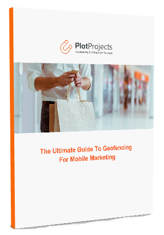 |
Want to know more about geofencing?Download the Ultimate Guide to Geofencing for Mobile Marketing to find out more about geofencing and beacons and why to use them in your app.
|
