Blog
7 best COVID-19 Apps
As a location intelligence company with easily integratable technology for apps, we love to see all of the location-tech apps being developed around the world. Location technology can be used across a number of different industries—from mobile payments to retail and travel to hospitality and beyond. At this time of global crisis, however, we see an incredible amount of Apps popping up to support in the response to COVID-19, which use location technology and that can be useful to support people to pick up their lives again as soon as lock downs are eased.
These are our top 7 picks of COVID-19 apps that use location tech and stand out from the crowd. These apps focus on contact tracing, information dissemination and crowd management, but there are many more apps and initiatives out there managing the pandemic and helping people to live their lives safely.
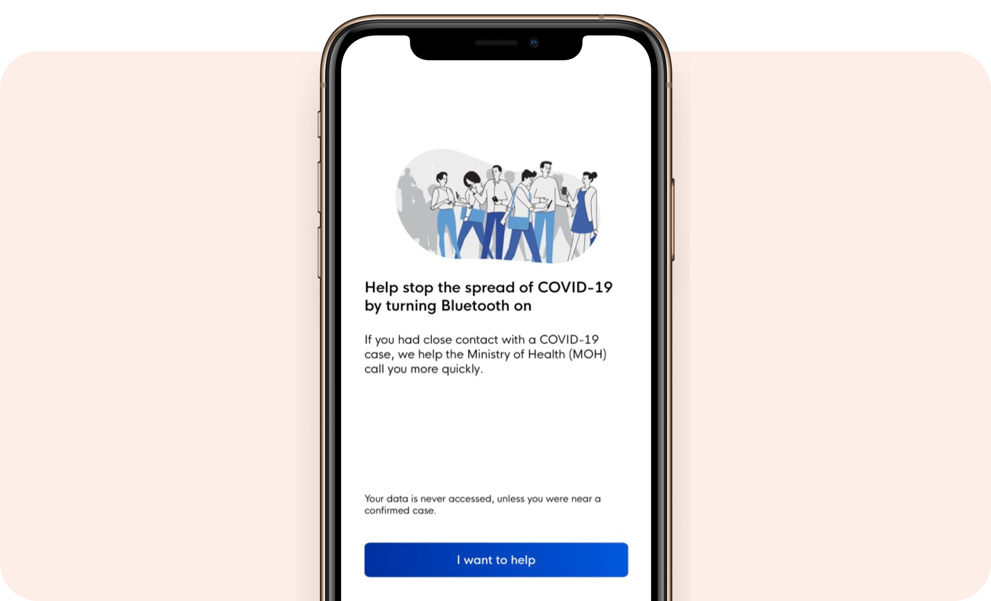
Singapore – TraceTogether is one of the first to launch such an app. It uses Bluetooth technology to identify other nearby phones that have the app installed. It then tracks when a user is close to others and uses timestamping to mark the encounters. The contact information between two users can be leveraged to determine how close and how long two users were with one another.


Visit TraceTogether website
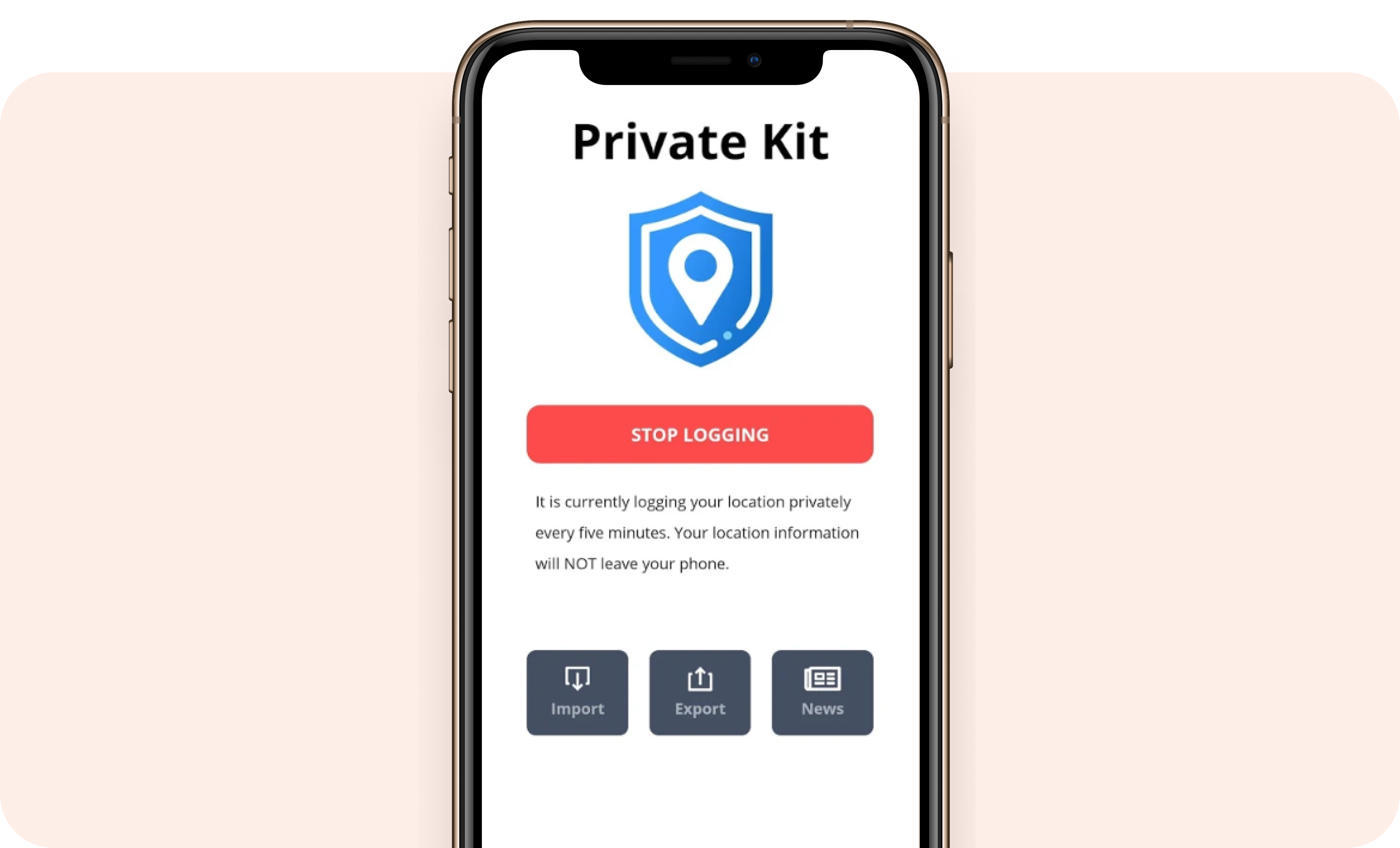
US – Private Kit: Safe Paths is a collaboration between the PathCheck and SafePaths teams of Harvard University and the Massachusetts Institute of Technology (MIT). In this app, users share their location data and can see if they have crossed paths with a person with coronavirus — as long as that person has also shared their positive status. Users are not able to see who the positive-testing person is. Individuals who test positive can opt to share their location data with health authorities, who then can make it publicly available to other users. The GPS trail is logged and stored locally (private) and the app seems to leverage both GPS and Bluetooth. The design looks promising and they have also teamed up with the Covid Watch initiative.
Visit Private Kit website
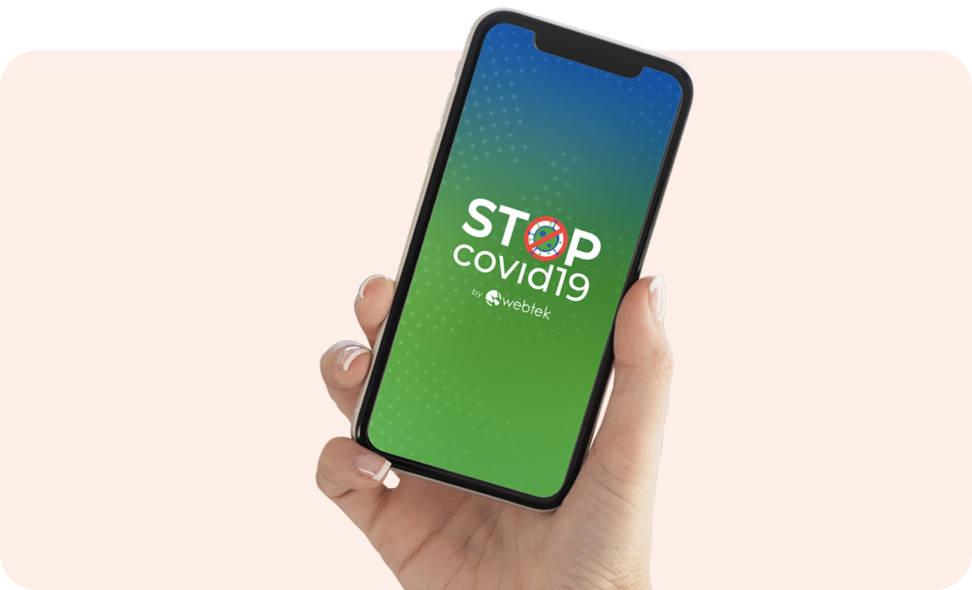
Italy – While still waiting to be approved in the app stores, the goal of the StopCovid19 app is to use Bluetooth-enabled backtracing technology to trace back the contact users have had with potentially infected people and to notify them if they have. With user’s consent, the app uses the device’s location data and memorizes a user’s movements. Health authorities can also get in touch directly with potentially infected people and take necessary measures to tackle further spread.
Visit StopCovid19 website
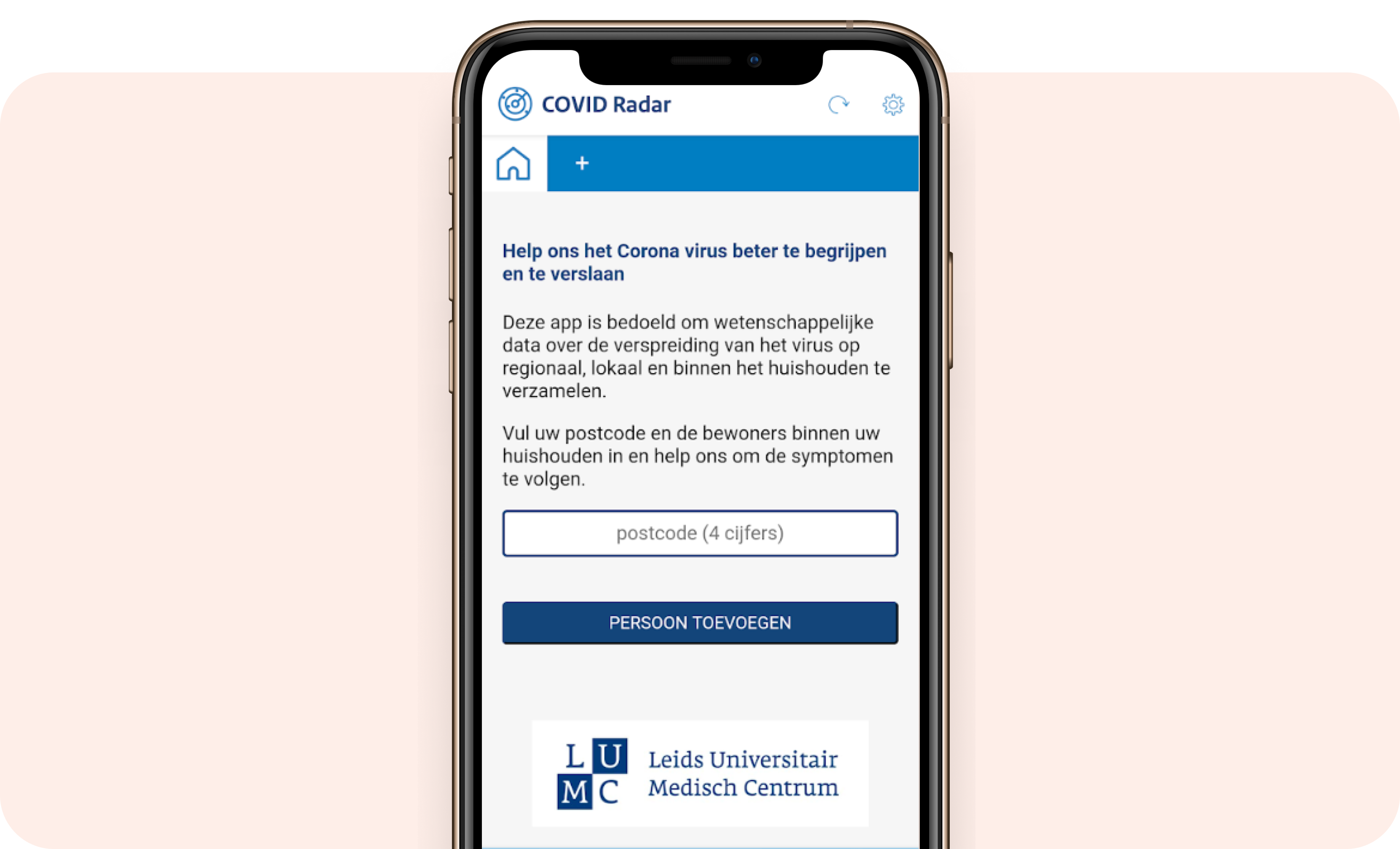
The Netherlands – In the Netherlands, testing has been limited so far, so COVID Radar is aiming to help with symptom tracking. The app works by collecting symptom data from as many users in the Netherlands as possible, to monitor how many people have (had) the coronavirus and where they reside in the country. With this data, COVID Radar tries to predict future care demand so authorities can see how many corona patients to expect when and where. The app avoids privacy issues and is used to inform and predict, as well as to help map the spread.
Visit COVID Radar website
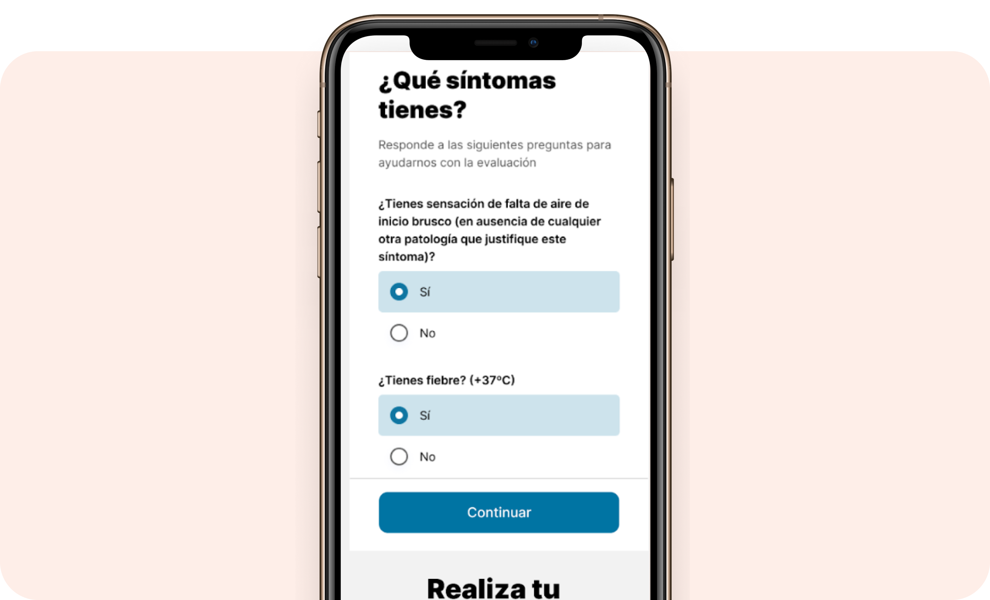
Spain – The Coronamadrid app enables users who feel unwell to evaluate their symptoms by carrying out a self-test if they notice any symptoms. Questions include, for example: Do you have a cough, a temperature or breathing difficulties? The app evaluates users regularly, offering recommendations based on the results. There is an optional location function to help the medical services to obtain the information to facilitate a faster and more efficient response in each individual case.
Visit Coronamadrid website
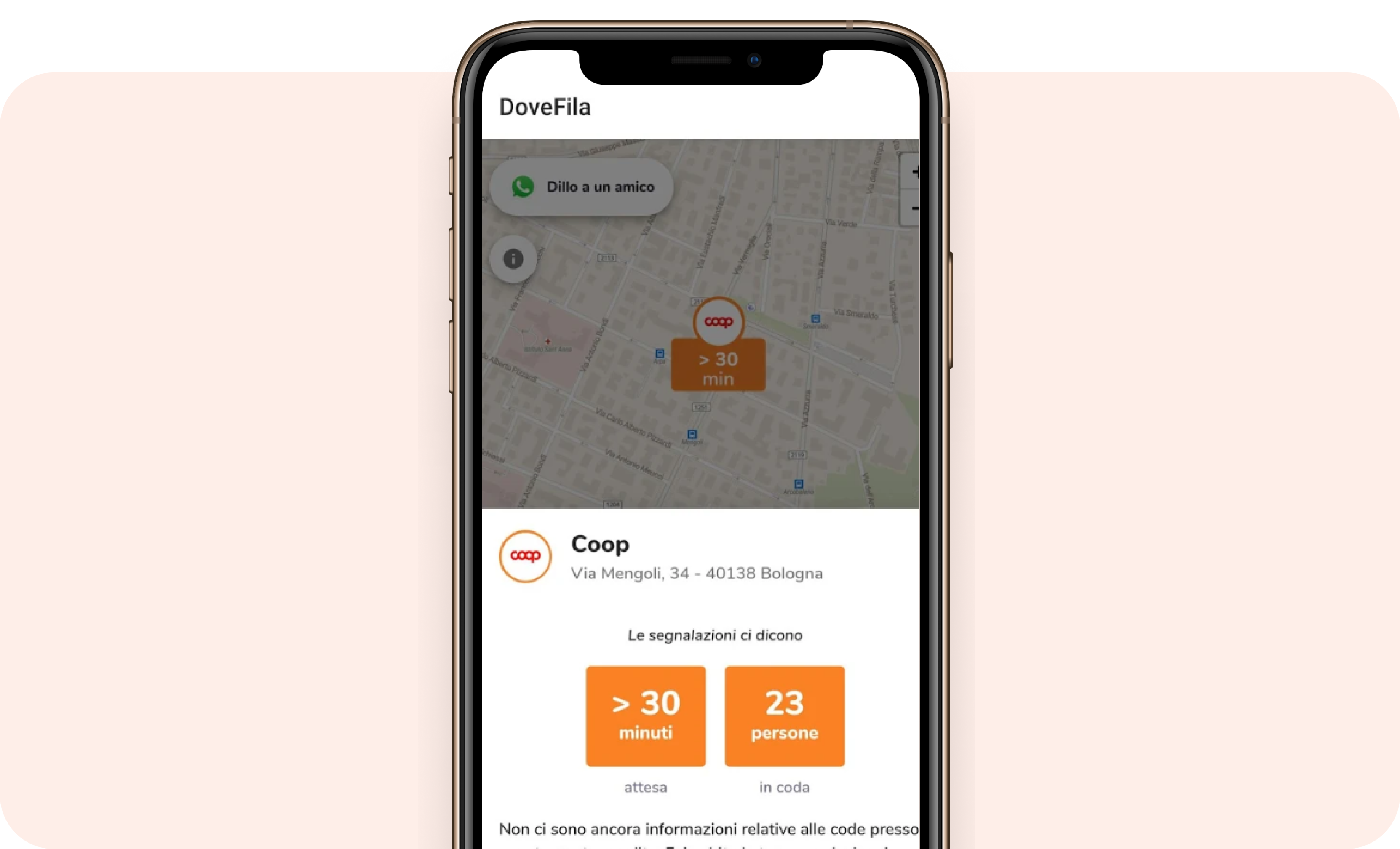
Italy – DoveFila is an app created by PlotProjects partner, DoveConviene. The app is a live map showing waiting lines outside various supermarkets to allow users to plan their visits when there are fewer crowds. Unlike U-First which only covers Milan, DoveFila works throughout Italy. The data shown is fed directly by users who use the service.
Visit DoveFile website
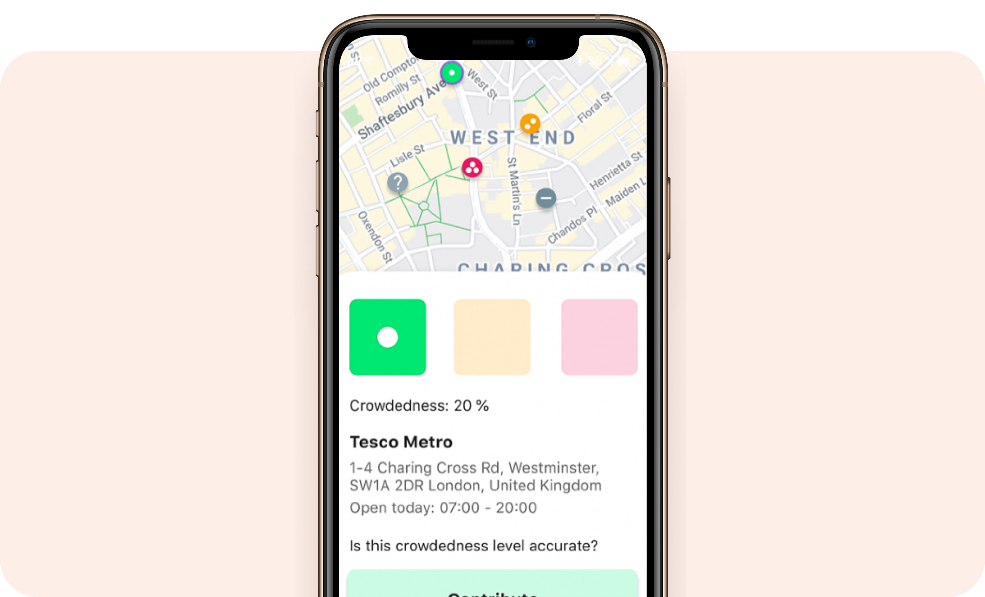
Global – Crowdless (formerly Keep Your Distance) is a still-to-be-launched app providing real-time data across the globe on the busyness of supermarkets and pharmacies, so users can plan their visits and maintain social distances. The app uses AI, Google Maps data and crowdsourced data, as well as the device’s current location to display the most relevant results and to make suggestions for other nearby, less crowded alternatives as needed. The app doesn’t collect any personally identifiable data.
Visit Crowdless website
Like the creators behind the 7 apps, PlotProjects is also committed to supporting app developers using location technology to better manage living with COVID-19. PlotProjects is offering its location tracking technology for free for up to 100.000 monthly tracked users (Pricing Growth Plan). We are also supporting apps with a fair pricing policy that need to reach more than 100.000 monthly tracked users (Enterprise Plan).
Our location-tech expertise can be leveraged for contact tracing, quarantine support, monitoring virus spread, crowd management, facilitating community help initiatives and so much more. Learn more about what PlotProjects is doing and how we can manage COVID-19 together so we can all live our lives smartly and safely.